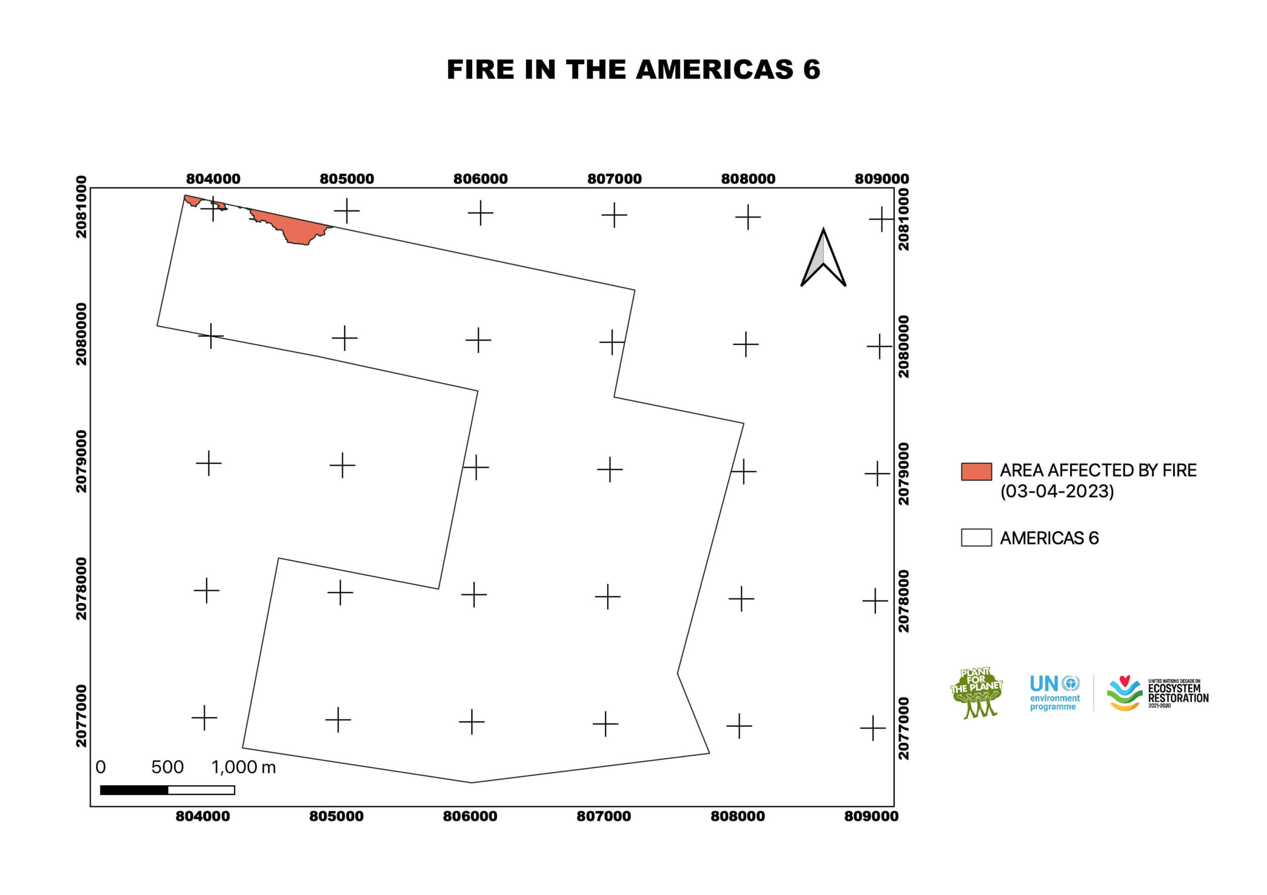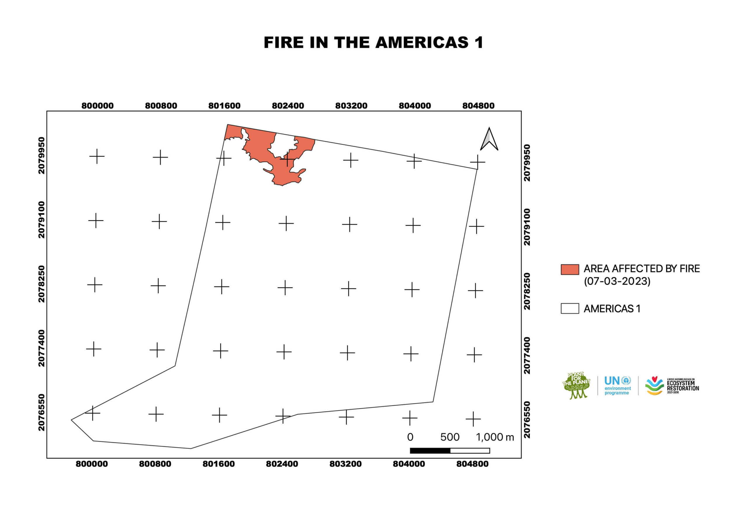
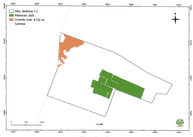
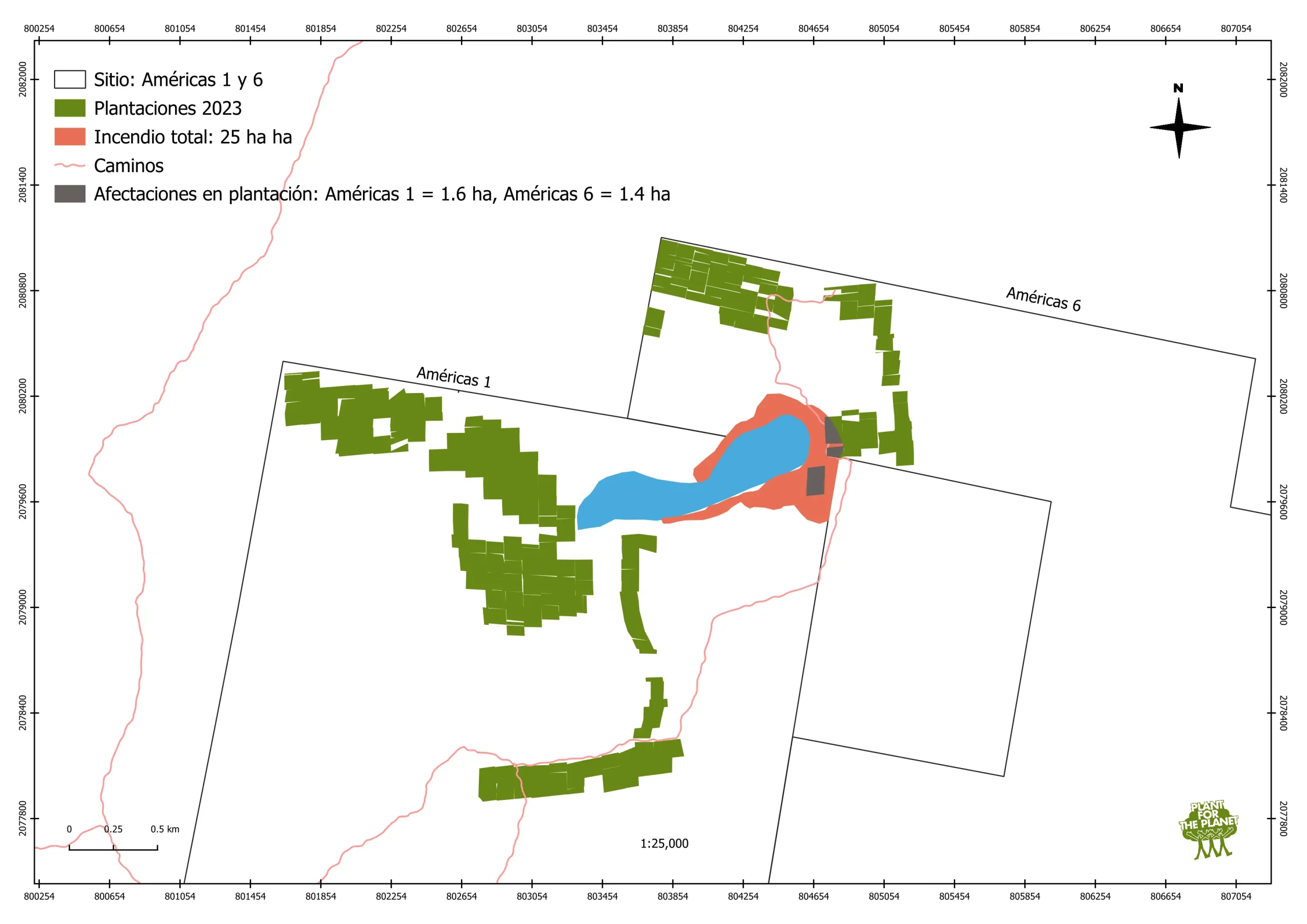
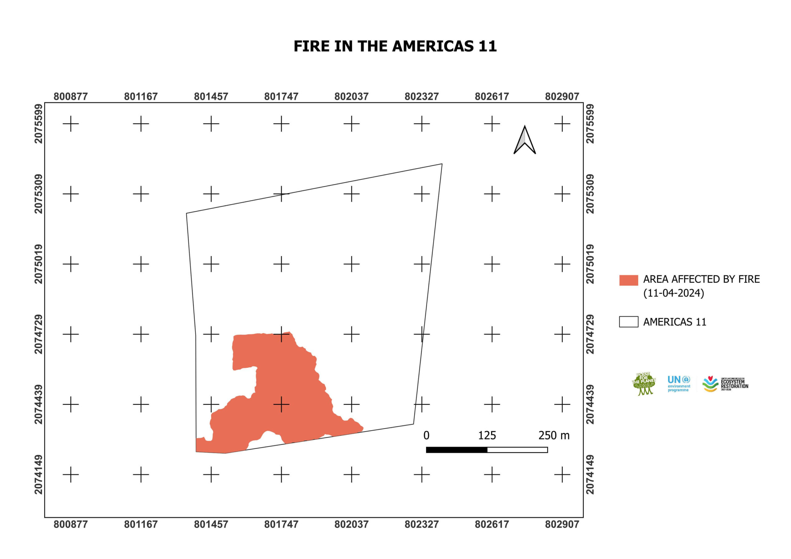
A fire started in the Las Americas 1 & 6 sites on the 28th April. It was detected and fought by the Plant-for-the-Planet Mexico team and successfully extinguished in the early hours of the 29th April. The fire burned 25 ha of land, of which 3 ha contained trees planted in 2023
(see map below).
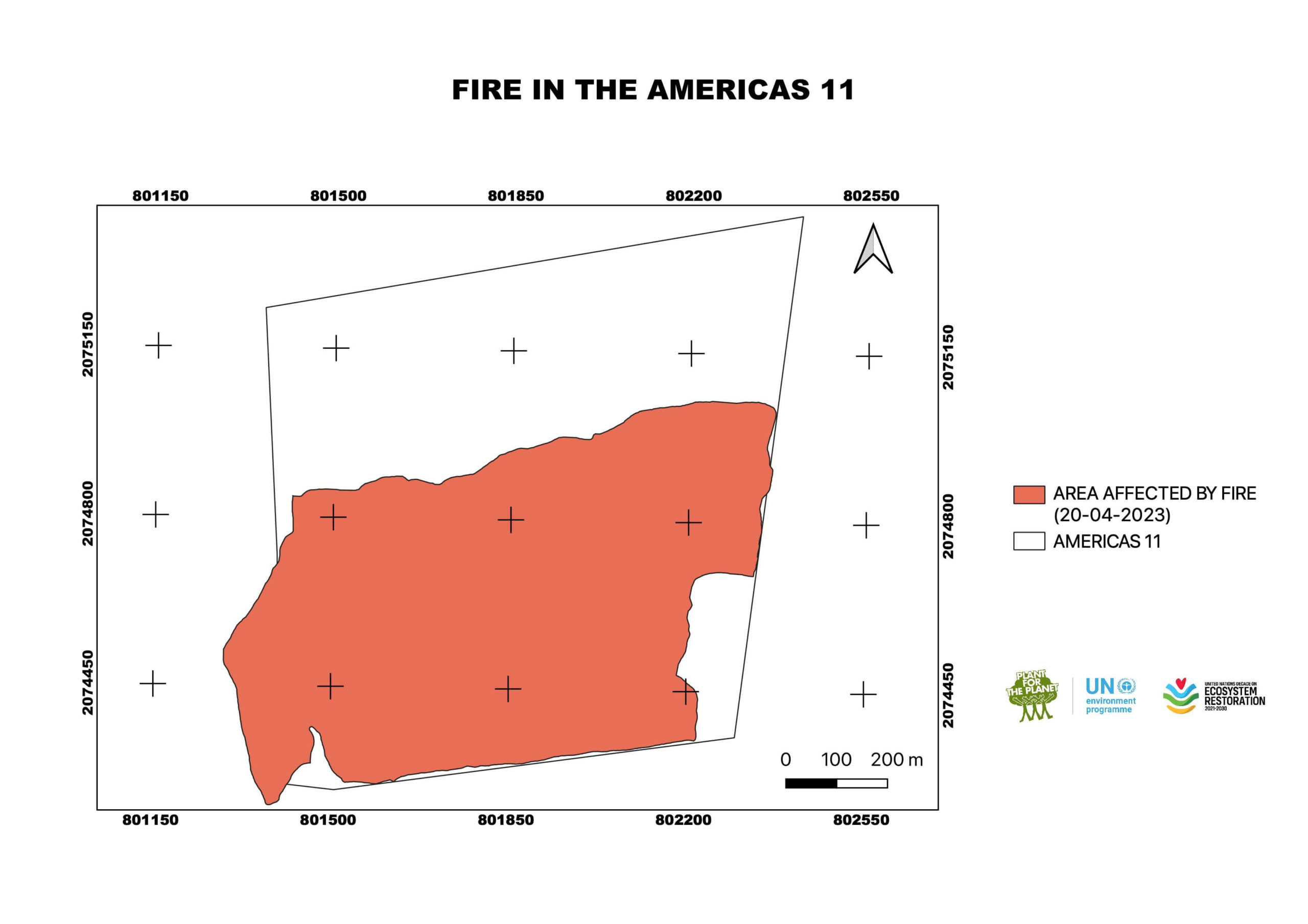
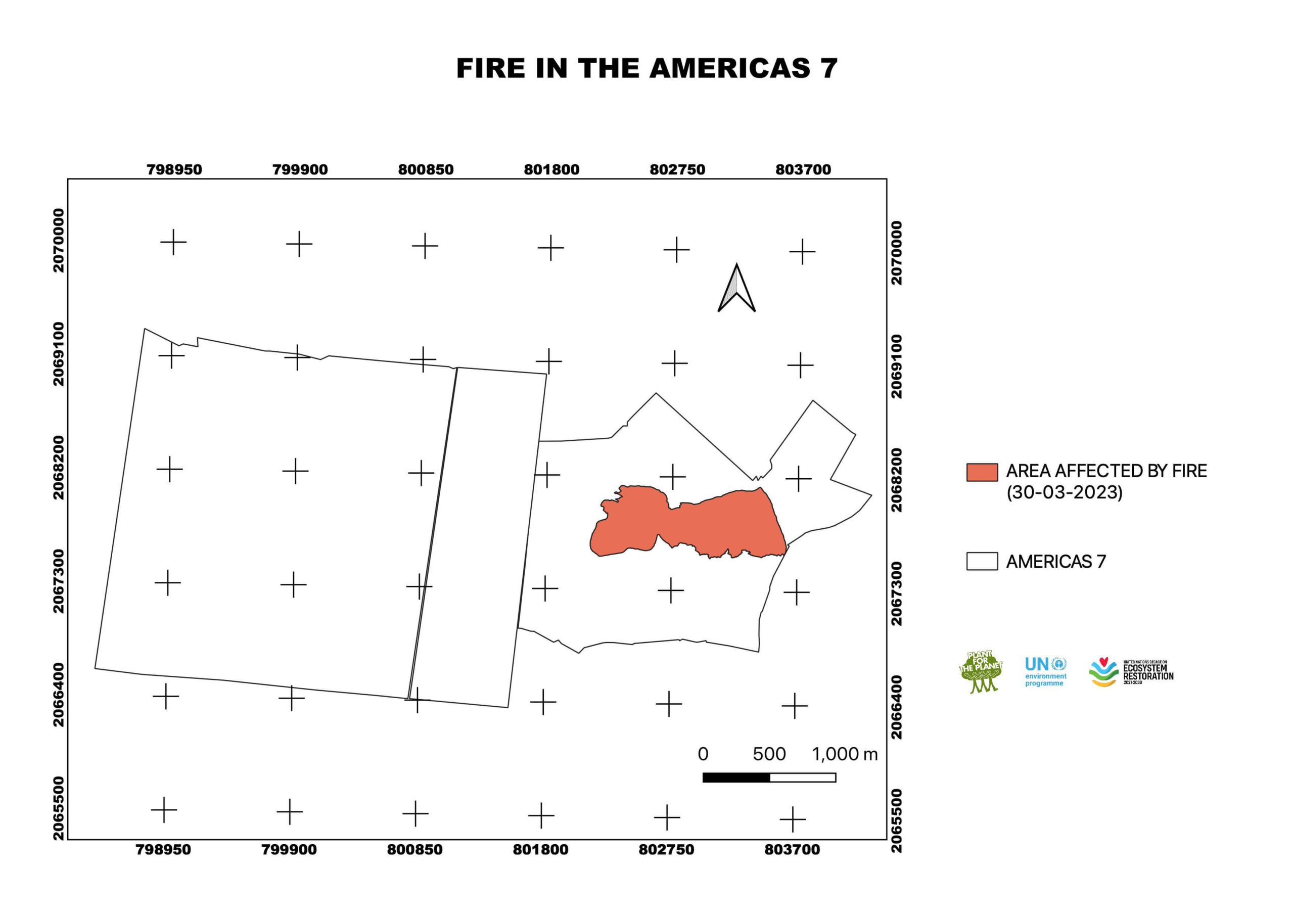
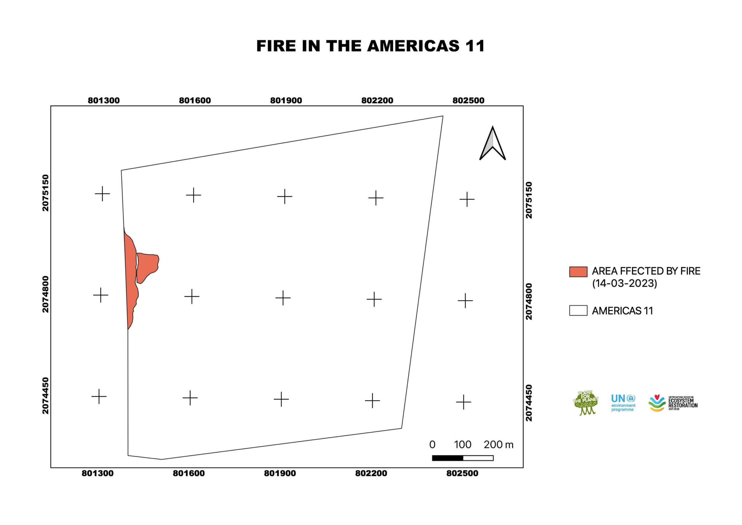
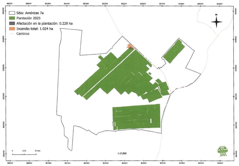
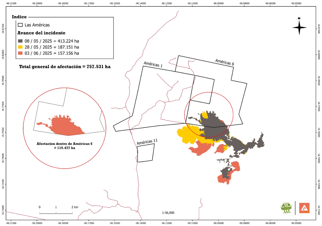
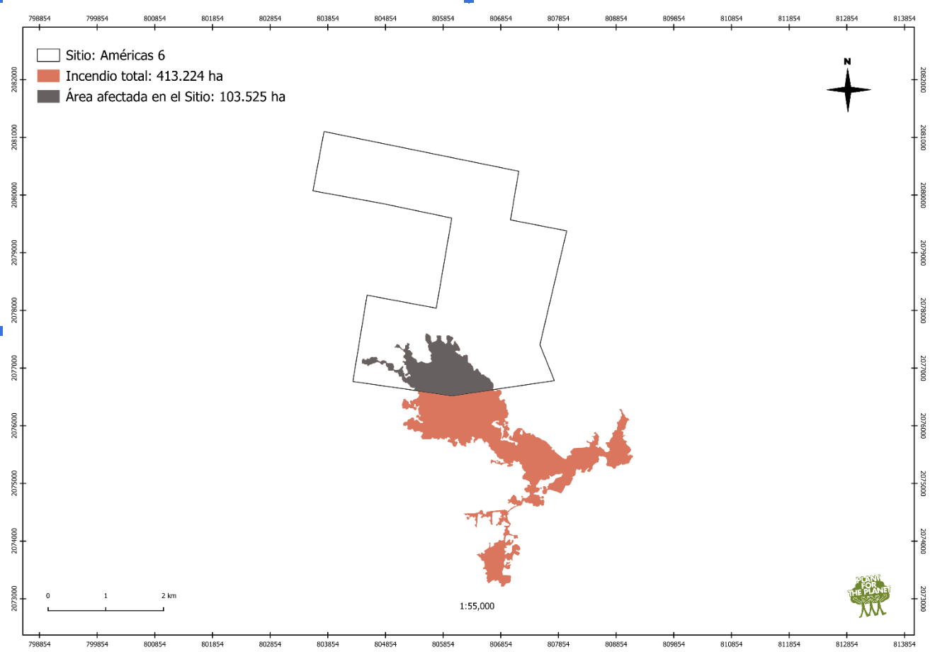
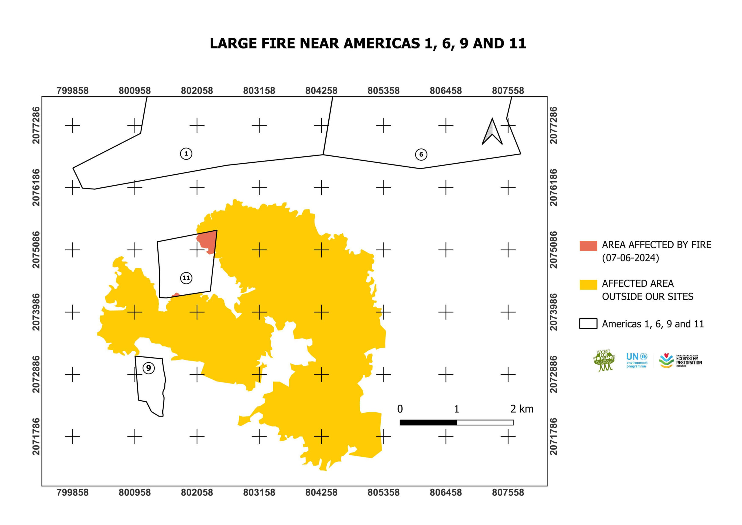
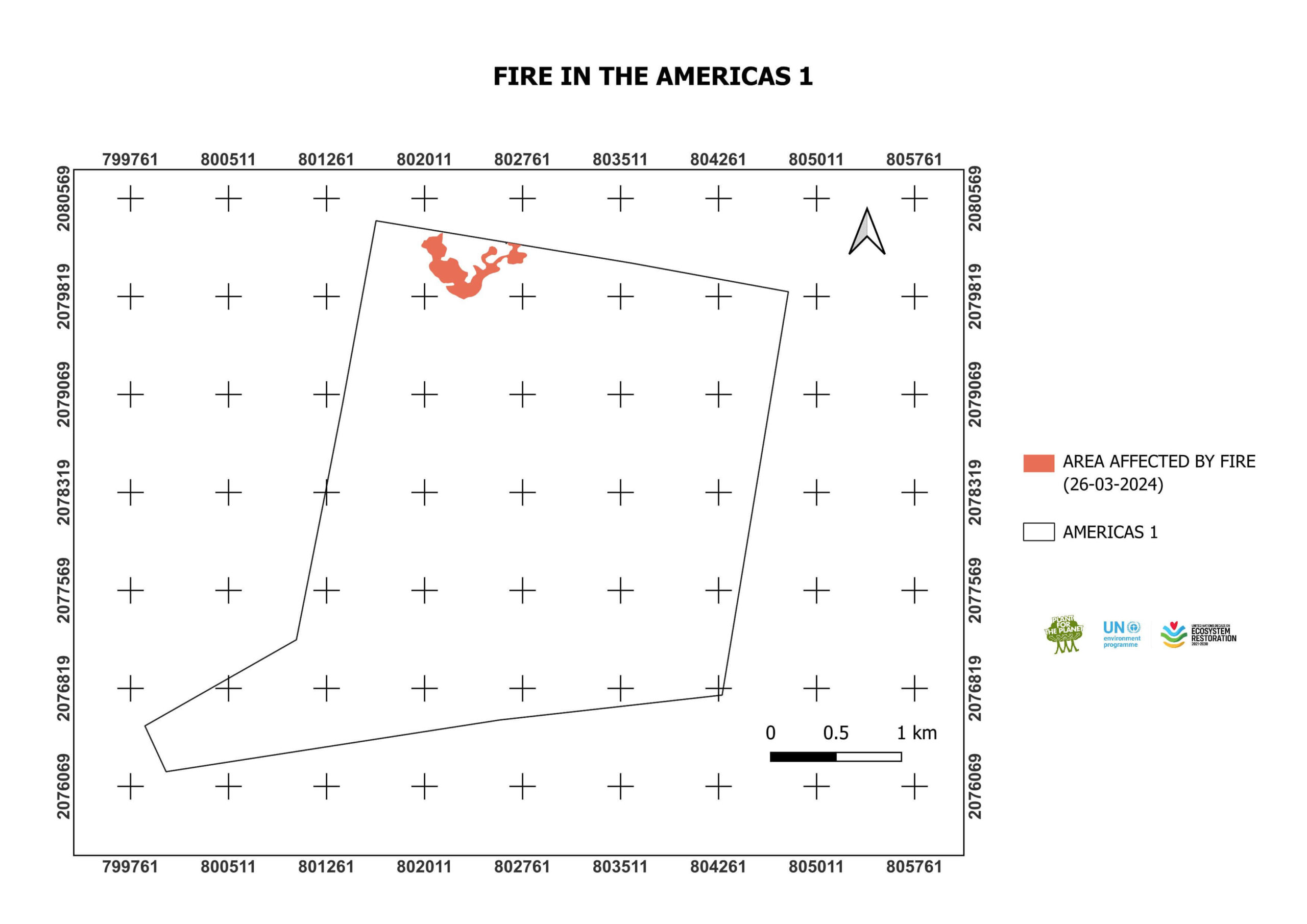
A fire started close to Las Americas 6 and Las Americas 1 on the 26th May. It was fought by a team of 40 people, including staff from Plant for the Planet Mexico and from CONAFOR. The area affected is an extension of the area affected in the fire that occurred on 5-9.5.2025
(see map below)
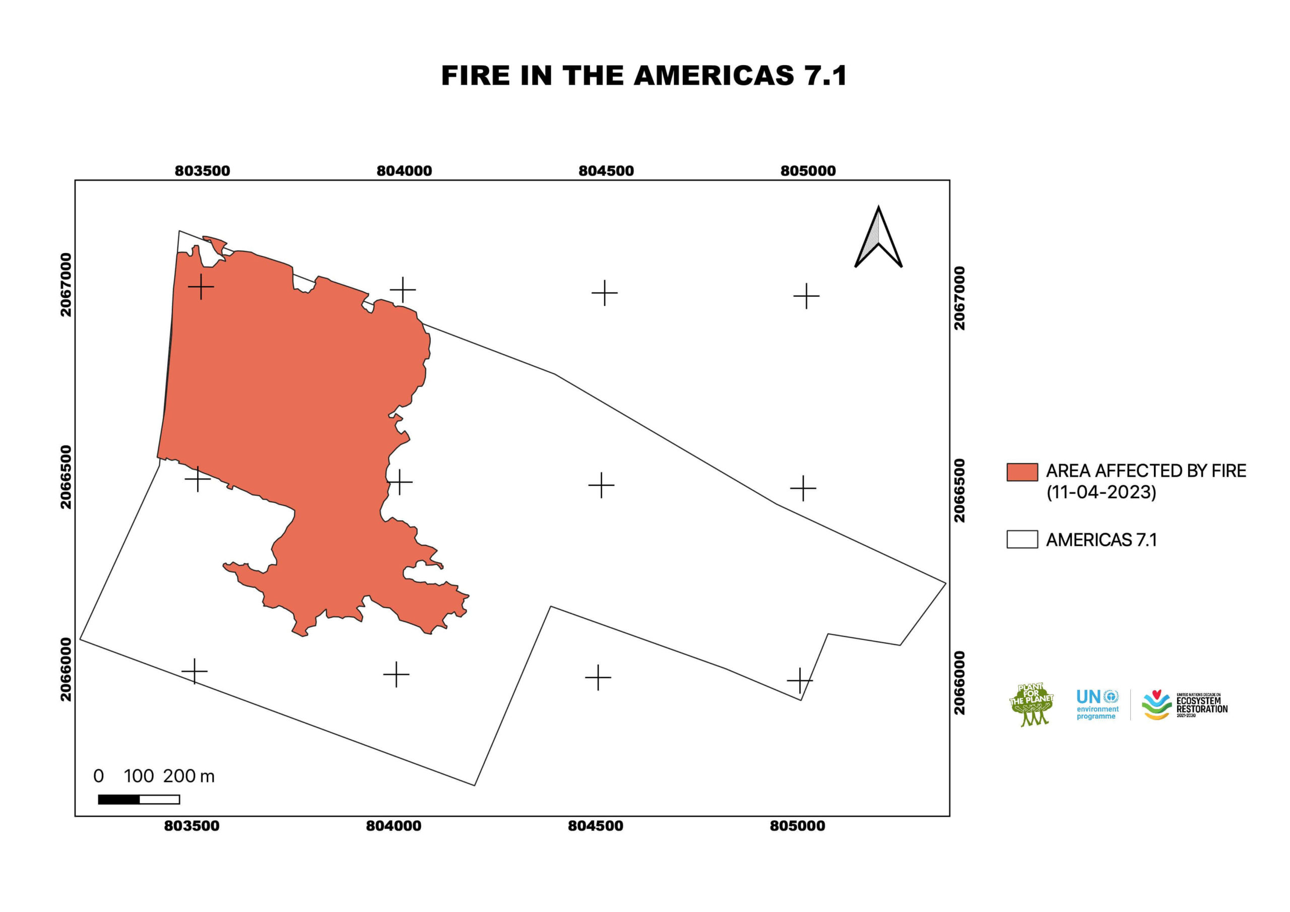
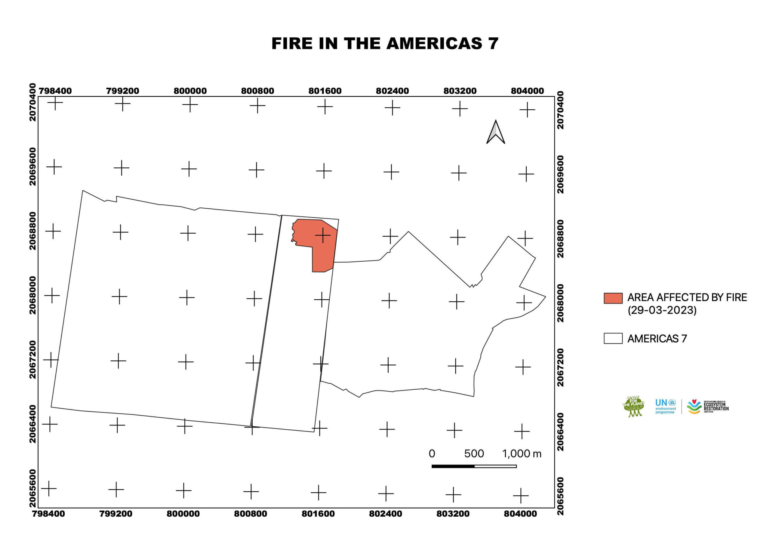
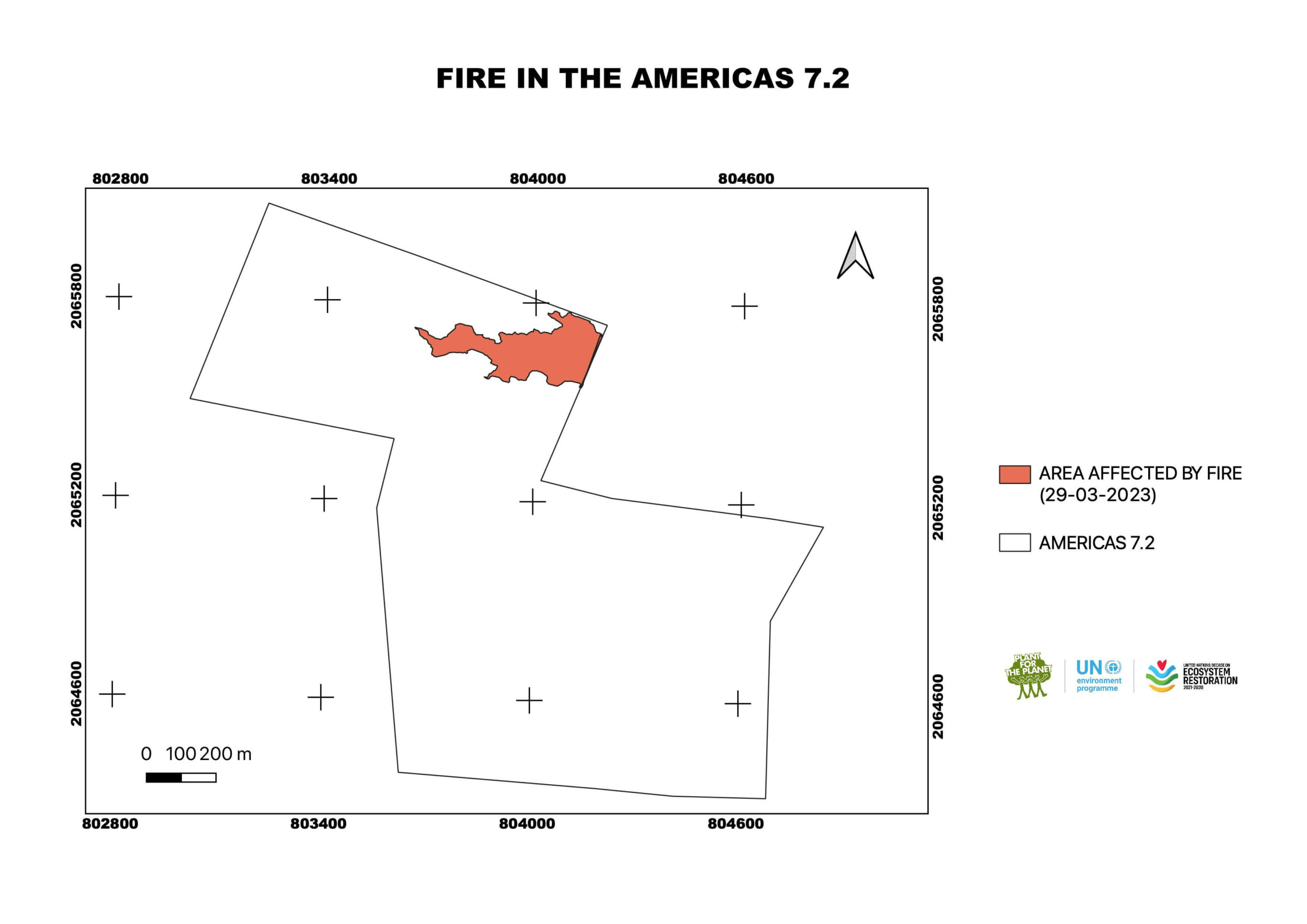
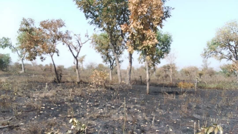
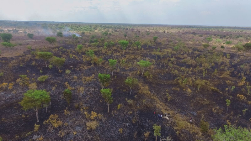
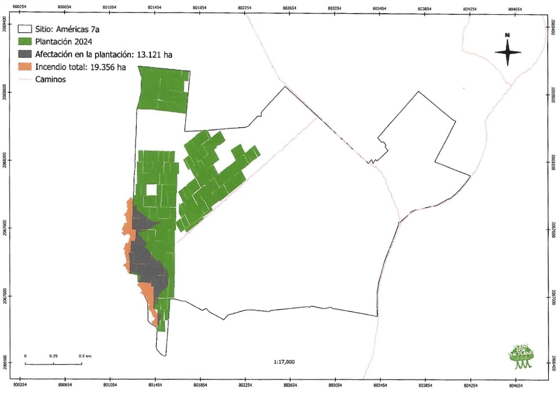
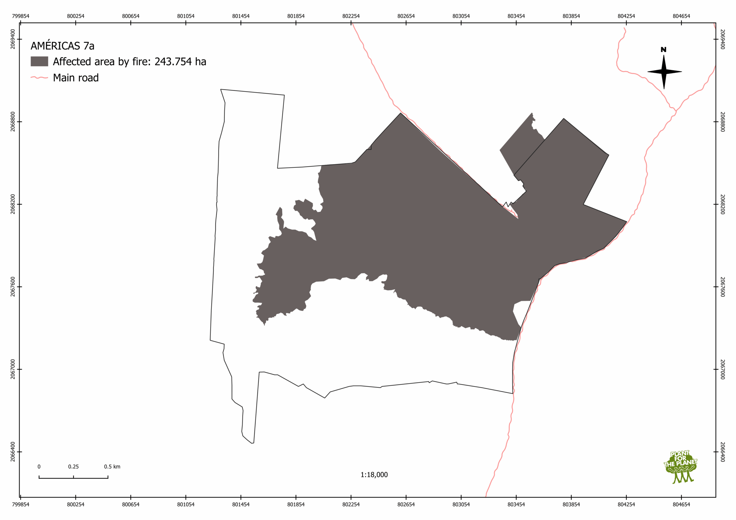
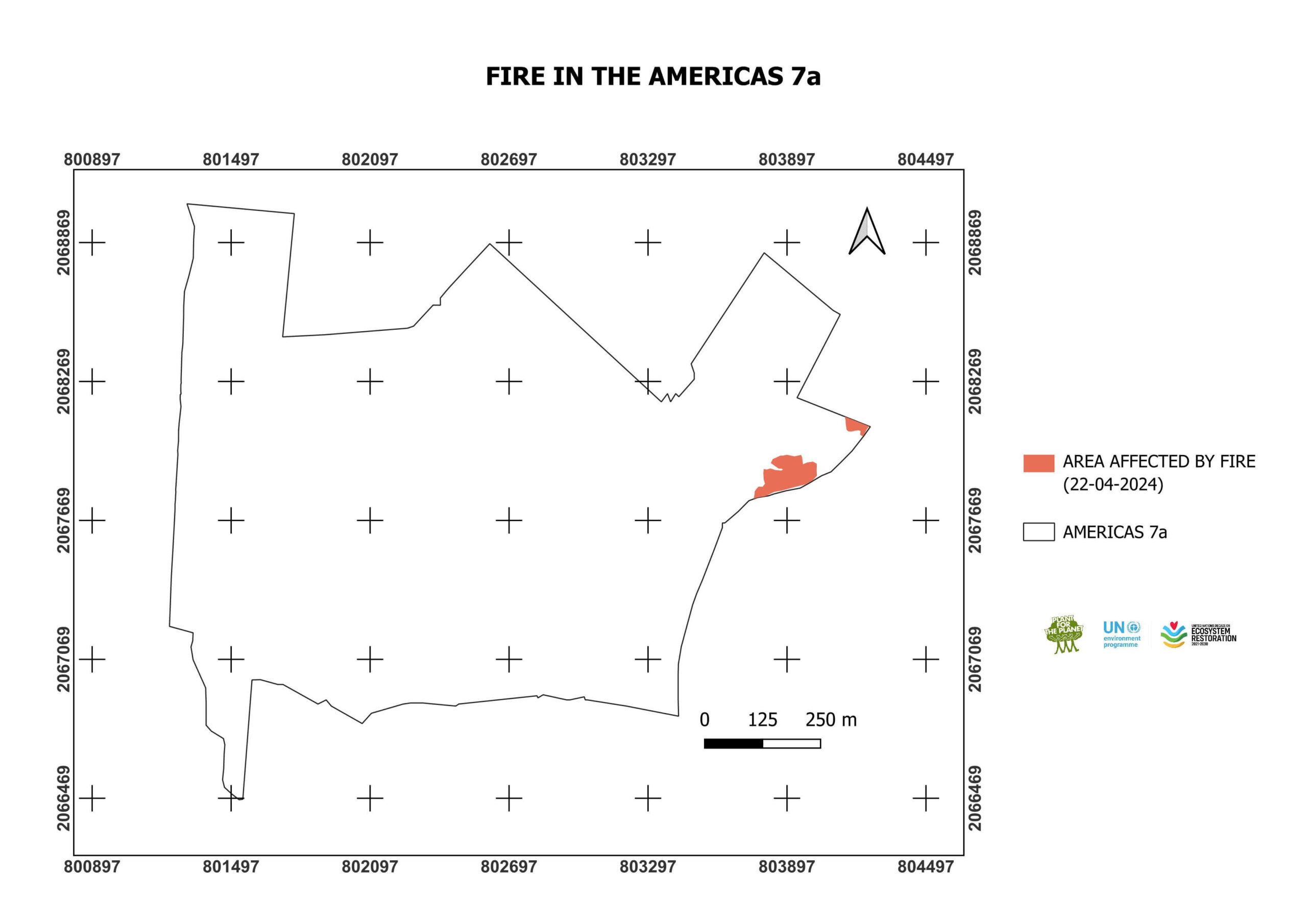
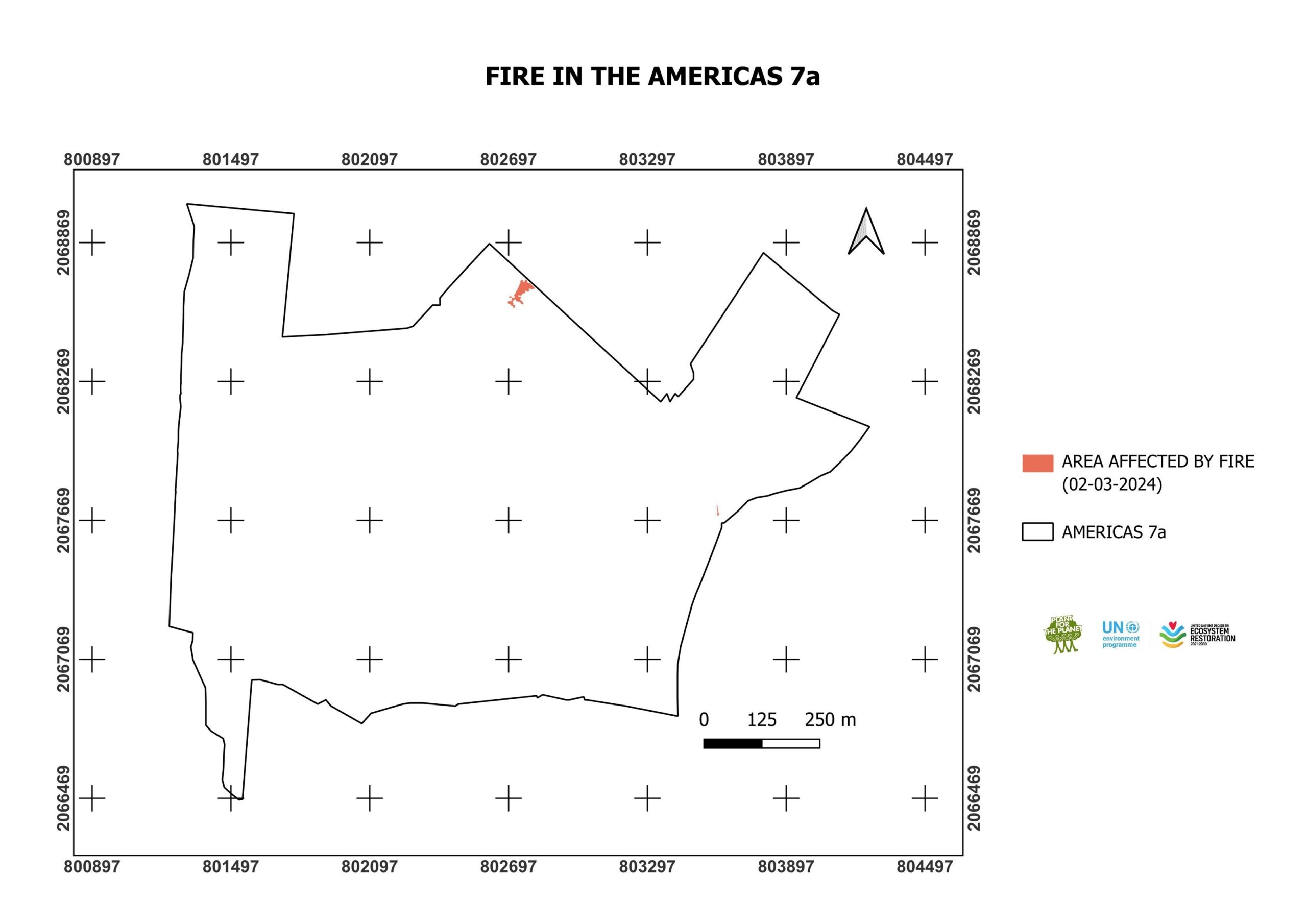
On April 23 and 24, 2025, the restoration site Las Americas 7a was impacted by a severe wildfire. The fire affected a total of 243.8 ha, of which 236.8 ha were within our sites. 24.2 hectares of this area were planted on in 2024. In this area, a total loss of the planted trees is expected, which means a total number of approx. 181,830 seedlings (this corresponds to approx. 10% of the total seedlings planted in 2024).For the affected areas that were planted in 2021 (90.2 ha), 2022 (82.1 ha), and 2023 (32.4 ha), the extensive root system developed by some of these trees allowed them to survive the fire and resprout in the following rainy season.
In August 2025, we re-surveyed survival in the areas originally planted in 2023. The survival rate of the trees initially planted was found to be 9.3%. Individuals of the following species were observed to have survived: Crescentia cujete, Guazuma ulmifolia, Haematoxylum campechianum, Cordia dodecandra, Gliricidia sepium, Havardia albicans, Lysiloma latisiliquum, Caesalpinia vesicaria (syn. Tara vesicaria).
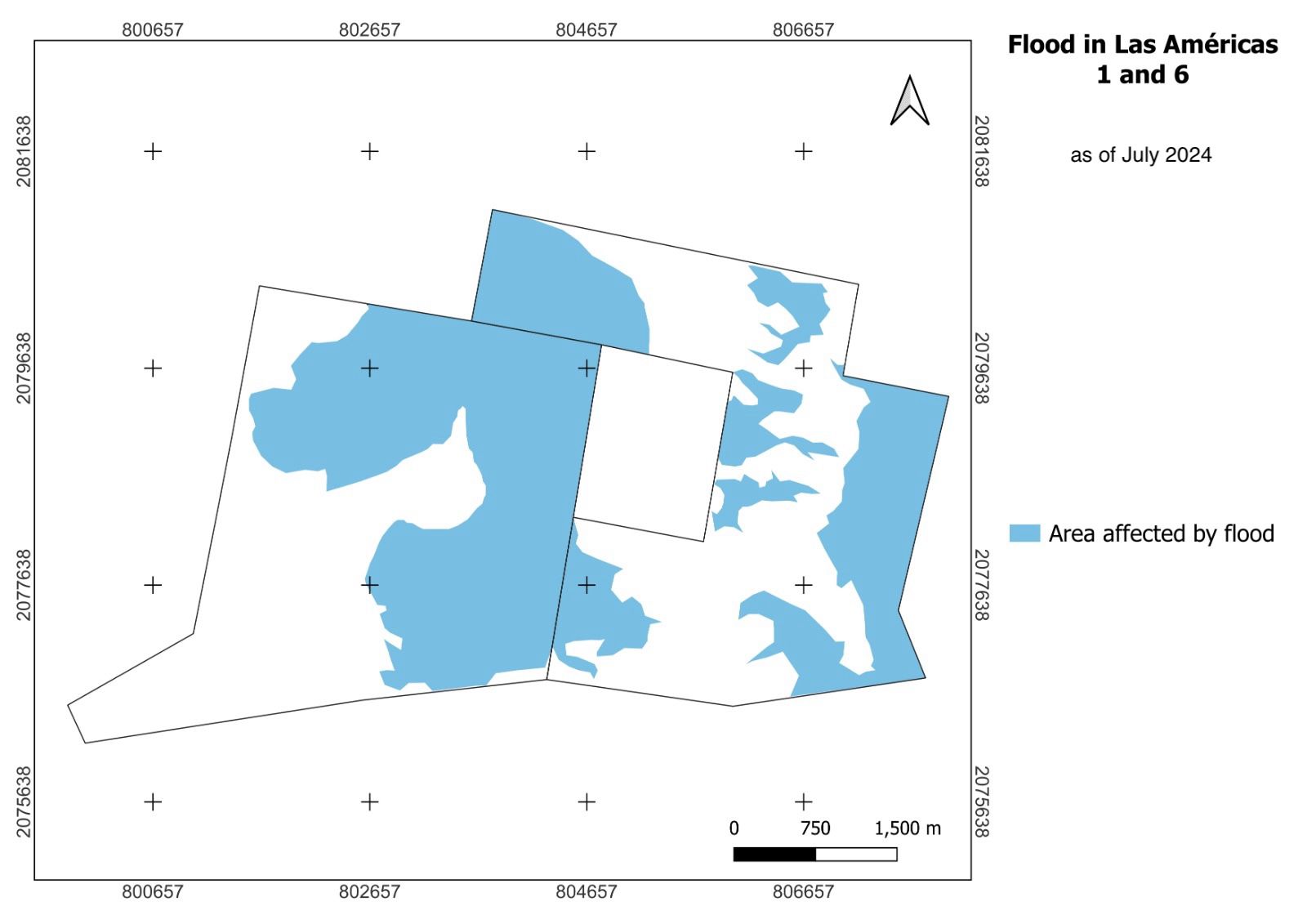
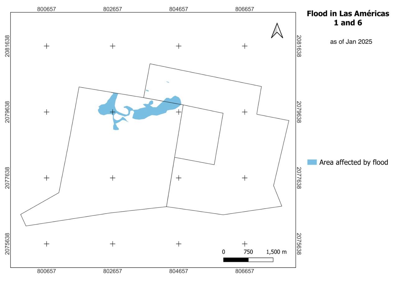
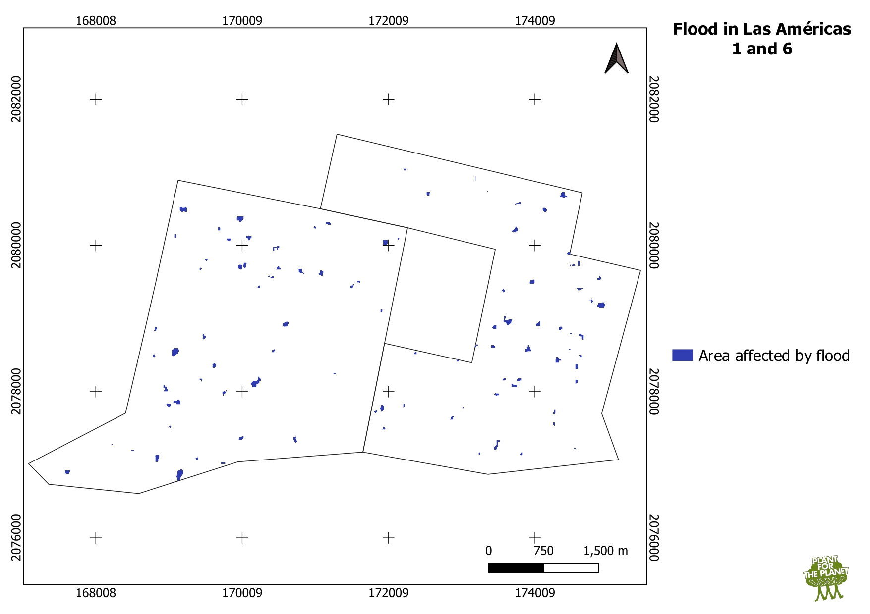
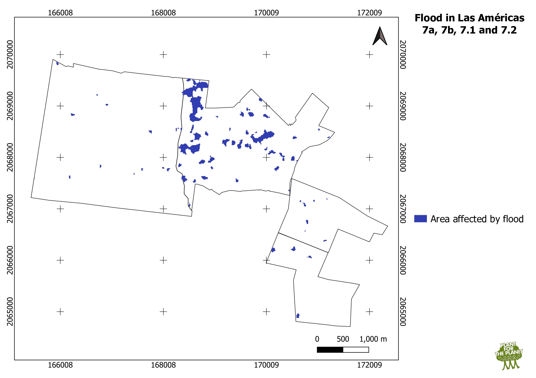
After several days of heavy rain we observed moderate flooding in our sites Las Americas 1, 6 and 7. The peak of the flooding was around the 6th of October. Across all these sites, a total of 51.2 ha were affected by some degree of standing water, in most cases limited to a few centimetres or less and limited to a few days. The most heavily affected area was Las Americas 7a. In that area, we planted a mix of tree species specialized on growing in contexts with large amounts of water. Therefore, we do not expect that we will experience excess mortality as a result of this flooding. In most cases, this added water was at levels where it was more likely to be beneficial than harmful for the plants.
The maps were made by using SAR (Synthetic Aperture Radar) data (vv and vh bands) from Sentinel 1 satellite of ESA. Water locations were calculated for the 5th to 9th of October.